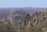
When the Pacific Plate collided with (and wrenched off a portion of) the North American plate, the San Andreas Rift Zone was created. A potential haven for volcanoes, this created the original Pinnacles formation (Neenach) 23 million years ago. As the Pacific plate inched up North, a part of the Pinnacles moved along with it, and today it lies 195 miles north of its original location.
Pinnacles National Monument is a decent place for a day hike, only
two hours from the San Francisco Bay area. My path let me explore all
geologic aspects of this Monument: I started off from the Chaparral
end and took  the Juniper
Canyon Trail (1.2 miles), took a left onto
  the Tunnel
Trail (0.6 miles). This was a fairly strenous portion of the hike
and it let enjoy some cool views:
 .
.
At the intersection of the High Peaks and Tunnel trails, I took a
left to explore a bit of the High Peaks trail and then walked back to
the intersection (2 miles total). Along this region of the trail, I
was able to see a  Condor's
nest and got some excellent footage of these graceful birds in
flight . Parts of this trail involve steep climbs on steps carved out
of rock
  . Again,
this presented some excellent views:
 .
.
I then took the High Peaks Trail all the way to Chalone Creek (2.6
miles) where I got to see  the
Pinnacles and took a leisurely walk along the valley on Old
Pinnacles Trail (2.3 miles) all the way to the Balconies Caves (0.4
miles)
  .
.
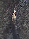
Navigating the caves in the dark is a lot of fun, particularly if
you're completely alone. At points, there is absolute no light and
all you have is a flashlight that you need to use to follow the
"trail" and watch for huge boulders  that hang
from the ceiling. Sometimes you have to
  squeeze real hard
to get through certain areas.
After I  climbed
out from the caves, I turned right back (0.4 mile) and went along
the
  Balconies Cliffs
(0.8 miles) as the sun was setting and headed back to Chaparral
(0.6 miles). Total trip: 10.9 miles.